
Farmers, like every other business owner, strive to enhance their mode of operation for productivity. One of the things you should do, particularly if you are just starting a new farm and want to make all the necessary efforts to make it stand out, is to map out your farm. This is essential if you want to get the most out of your land’s resources, and it demands strategic planning and technical expertise.
What is Farm Mapping?
Farm mapping is one of the foundational things you want to do when it comes to setting up the farm. It is one method that enables farmers to greatly enhance the way they manage their farms.
Farm mapping helps you get a broad perspective of your farm. You get access to a dynamic tool that enables you to track changes in land usage over time. Farm mapping will help you to predict how your activities will develop over time.
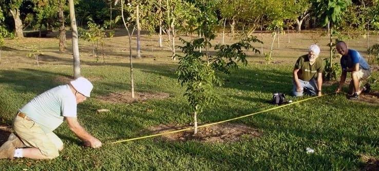
To start setting up your farm, the crucial first step is to map it out. Farm mapping allows you to make detailed measurements of your farms. By doing this, you can have a clear idea of what you want your farm to look like.
The Benefits of Farm Mapping
Farm mapping will assist you in understanding the scale and size of your farm, which is essential for the many management decisions you must make.
With the use of farm mapping, you can quickly plan out your operations in the future, which will also help you steer clear of any issues that might interrupt farm operations and productivity. For instance, mapping out your farm will help you visualize how many beds you want to design or what crops would work best on the farm.
A farm map will help you identify areas that can be easily contaminated on the farm.
Farm maps could also be helpful in detecting practices that can cause soil and water contamination. This will then give you the opportunity to create a plan on how to best prevent them.
Using a farm map will help you identify the various topographic features. Topography describes the surface features, patterns, and arrangements of the land. With the use of farm mapping, you will be able to come up with solutions to problems that can arise due to topography, such as slopes.
Additionally, a farm map will assist in identifying different soil types on the farm and their features. This will enable you to determine whether the farm’s soil is suitable for the crop you wish to plant, whether it is prone to erosion, and the best ways to utilize it for better output.
How to Map Out the Farm
It is advisable to seek the help of experts in the process of mapping out the farm. At Farmwella, here are few of the steps we usually follow to help farmers get the best out of their farm as regards farm mapping:
1. Find a Location for your Farm
Finding a place that would work for your farm is the first step in setting up your farm. There are a number of factors to consider when finding a location that will be suitable for your agricultural production.
You must conduct a feasibility study and evaluate the availability of roads, power, network, proximity to market and water, as well as how these factors will impact the farm. Once you have the location, you can concentrate on the subsequent technicalities.
2. Label or Give Your Farm Land a Name
Giving your farm a name makes it unique and helps to establish personality and even a little bit of permanence. No matter how small or big your farm is, once you have a piece of paradise, it is natural to give it a name. It helps you to promote it as a business. People will come across your farm sign post to be aware of the development either intentionally or unintentionally. A farm with a name can become a landmark, a description guide, among other existing features in your farm environment.
3. Know your Farm Boundary and its Surroundings
Knowing your farm boundary allows you to fully explore your farm without any conflict with the neighboring farm or farm surroundings. It enables you to have control over what comes out or inside of your farm.
Identifying your farm boundary helps you estimate the cost and type of security system to adopt to prevent theft, wildlife, to name a few.
4. Divide and Measure your Farm Units
Farmland is divided depending on characteristics like terrain, soil type, wetland, upland, etc. This will assist you in choosing the best crop variety or environment for the type of cropping system. The process will also help with siting of structures—such as nurseries, offices, residential homes, storage sheds, garages, and underground utilities—that need to be put in place.
Understanding each farm land unit’s dimensions facilitates measuring the production of each unit area and improving the display of each farm land unit on a map. Dividing farmland into units also makes it easier to administer. By treating each unit as its own organism and organizing the available resources for optimal output.
5. Sketch out your Farm
Farm sketch can be drawn with little or no cost. It allows you to represent features of your farm, farm boundary, or land units. It allows you to adjust and make amendments to how you want your farm to be configured.
Sketching out your farm will also give you an overview of your farm layout and opportunity to plan out all activities and allocation of resources.
6. Digitize your Sketch
Farm map can be developed from sketching to architectural plan, Google map or GIS depending on the choice of the expertise. After proper considerations and adjustments have been made to a farm sketch, it can then be digitized or processed into a map.
Aside from your farm features and plan, a good map should also have a title, north arrow, easy to interpret legend or key, scale and grid line, symbols that are simple and easy to understand.
Conclusion
When setting up your farm, getting your farm map done shouldn’t be an option, you should make it a necessity because of its essential roles in the development and presentation of your farm.
Even to newbies, it helps in navigating through the farm as it also provides detailed information, ranging from its measurement to features like topography, wetland, stream, soil type, underground pipes, farm structures and their spatial relationship.